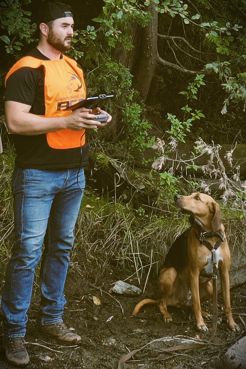
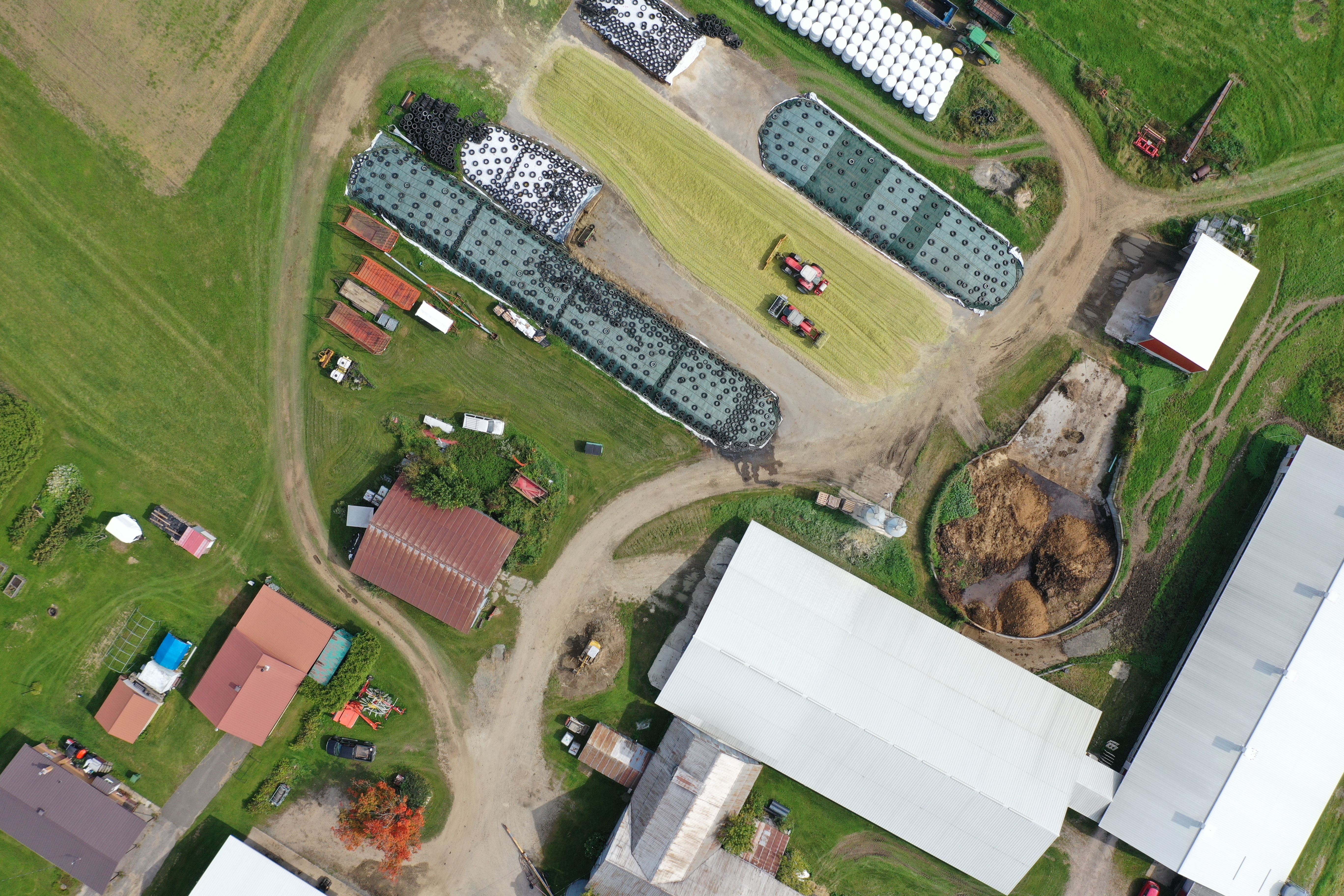
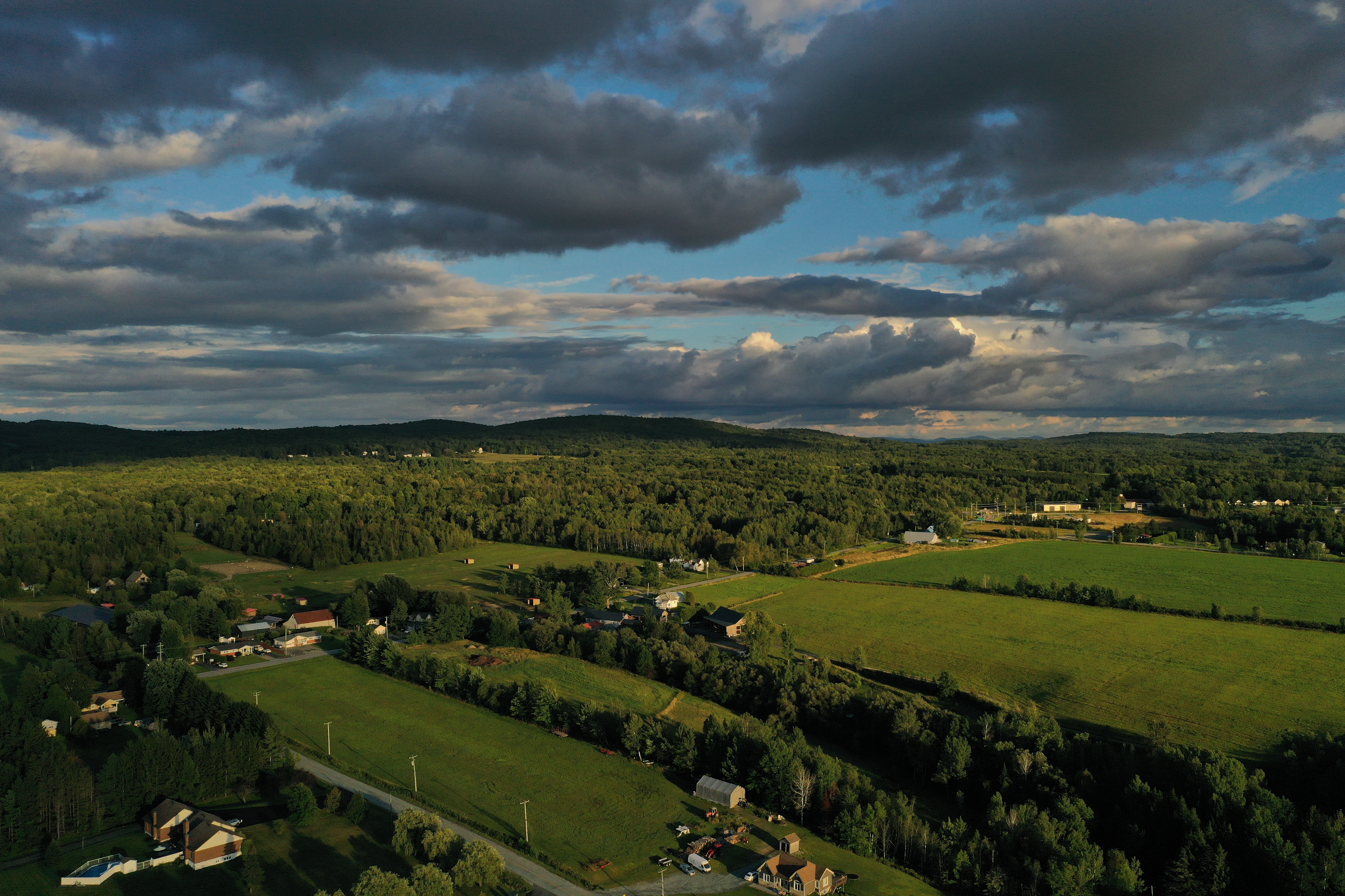
SERVICES

Drone imagery acquisition for creating precise maps and photos, optimized according to your needs to serve eastern Quebec

01

Drone pilot

Certified by Transport Canada for advanced operations missions
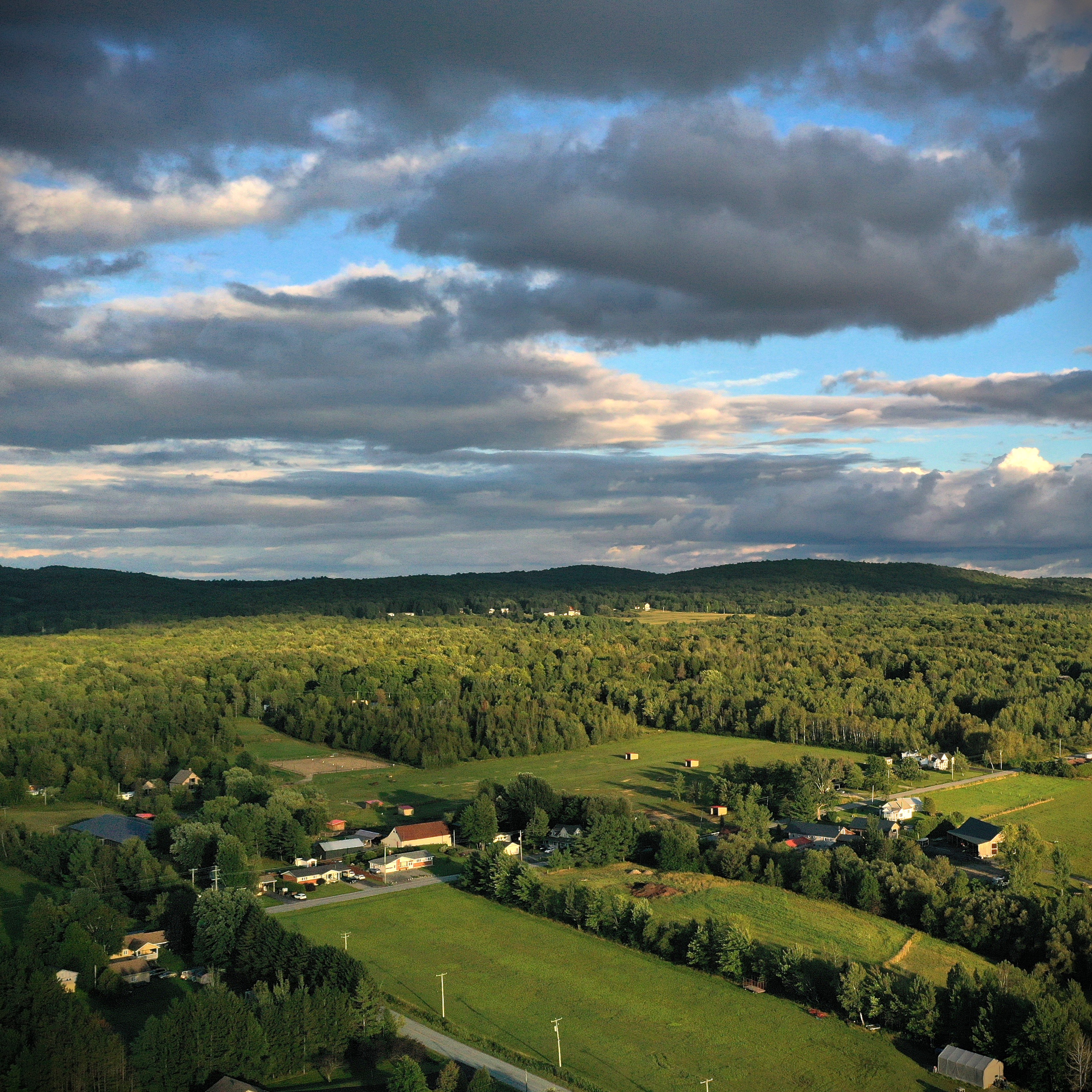
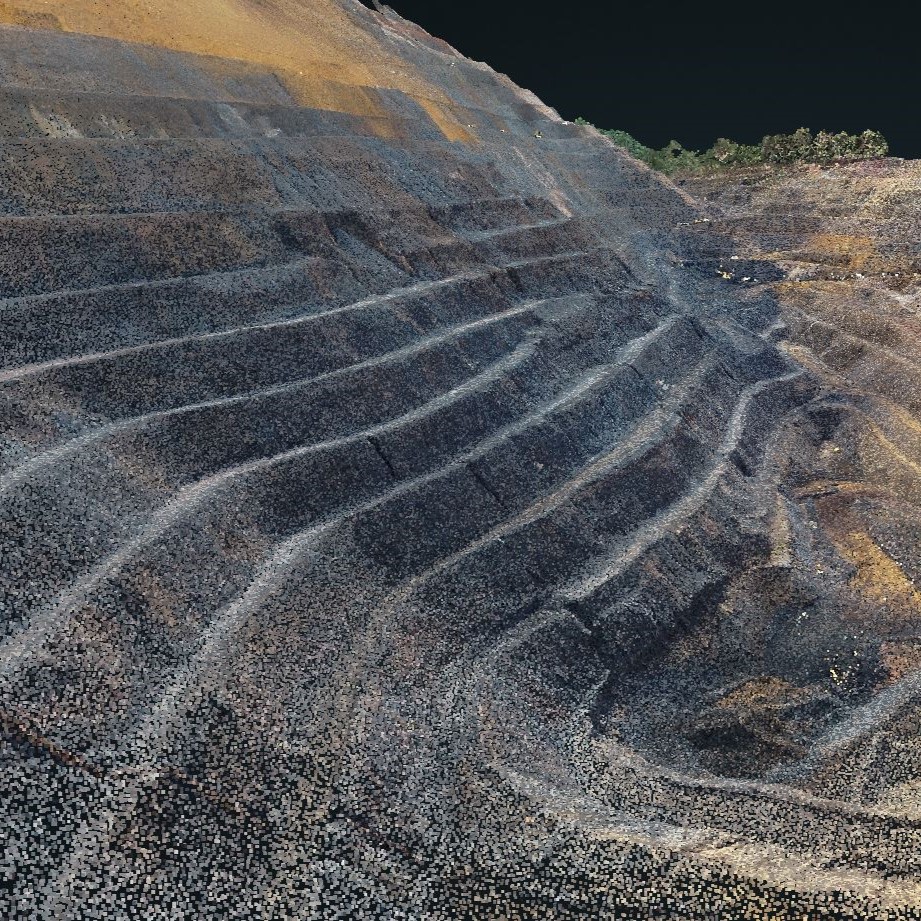
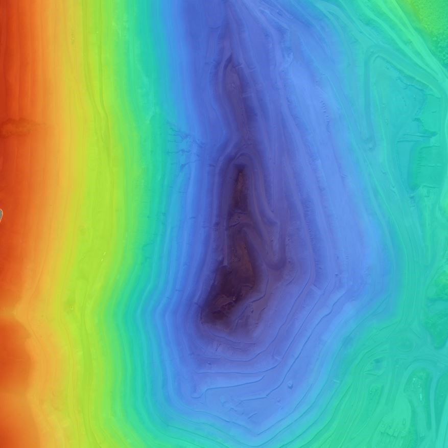
02

Photogrammetry

Orthomosaics or 3D products, we have the necessary expertise
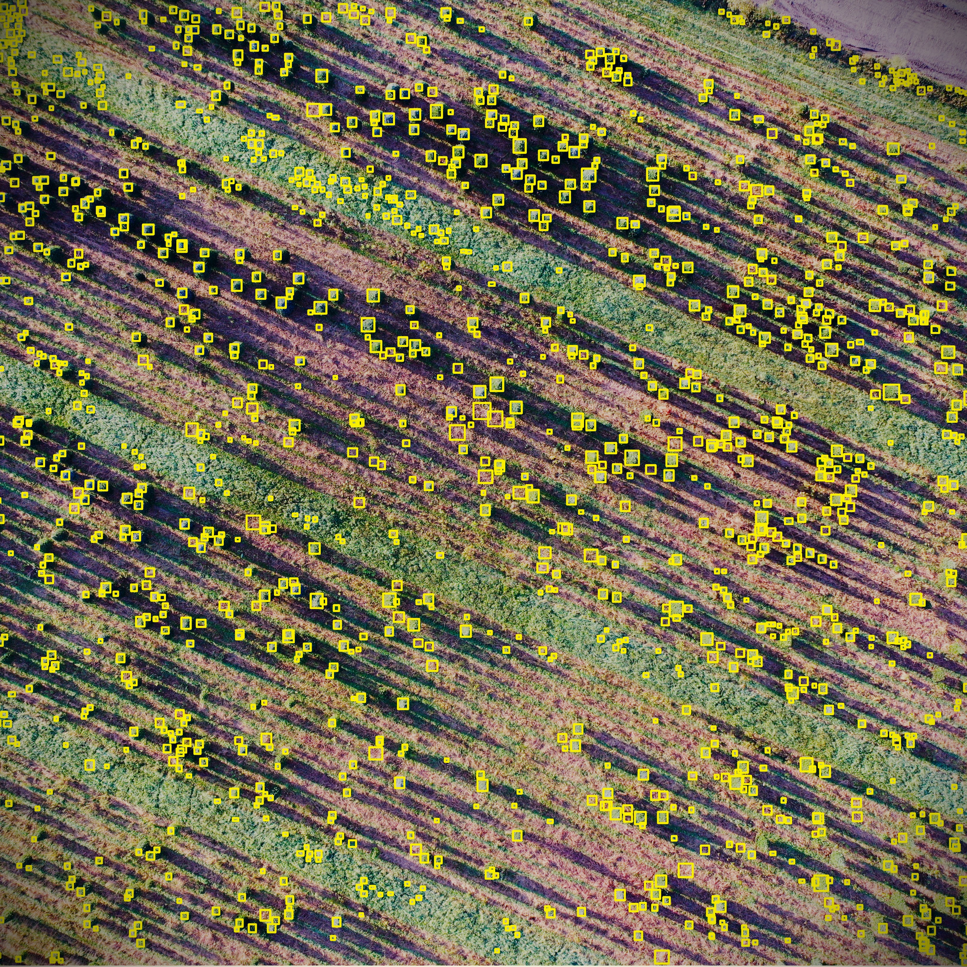
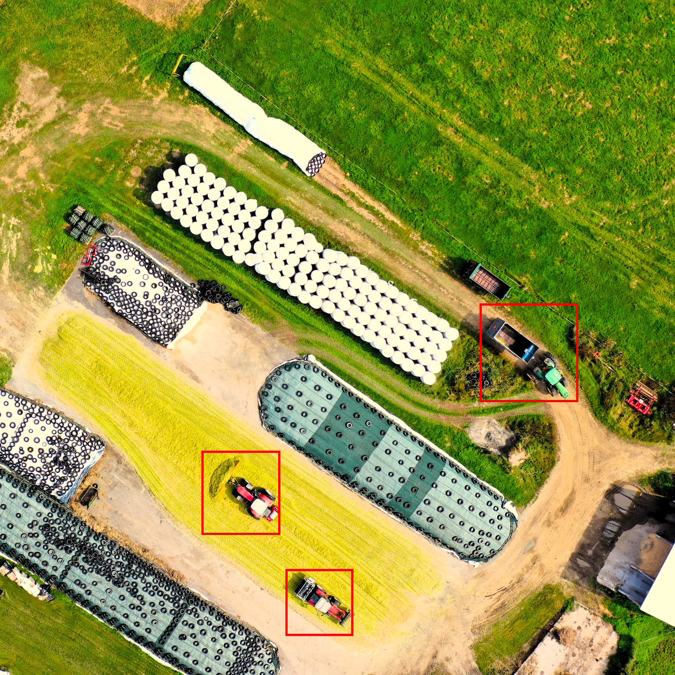
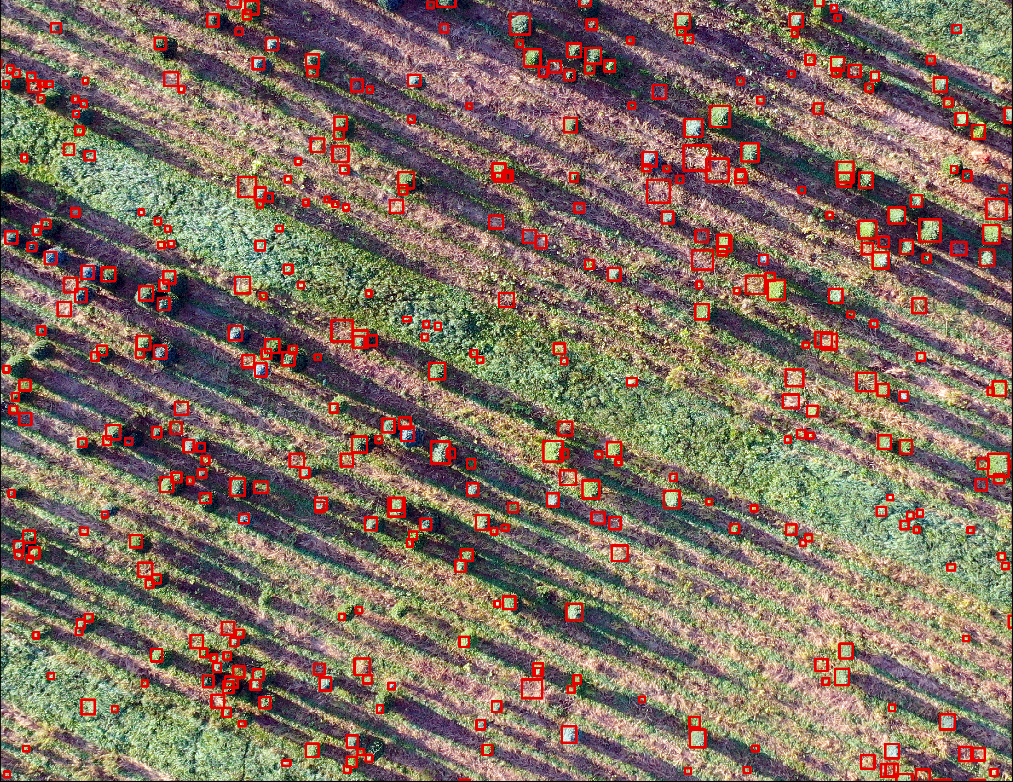
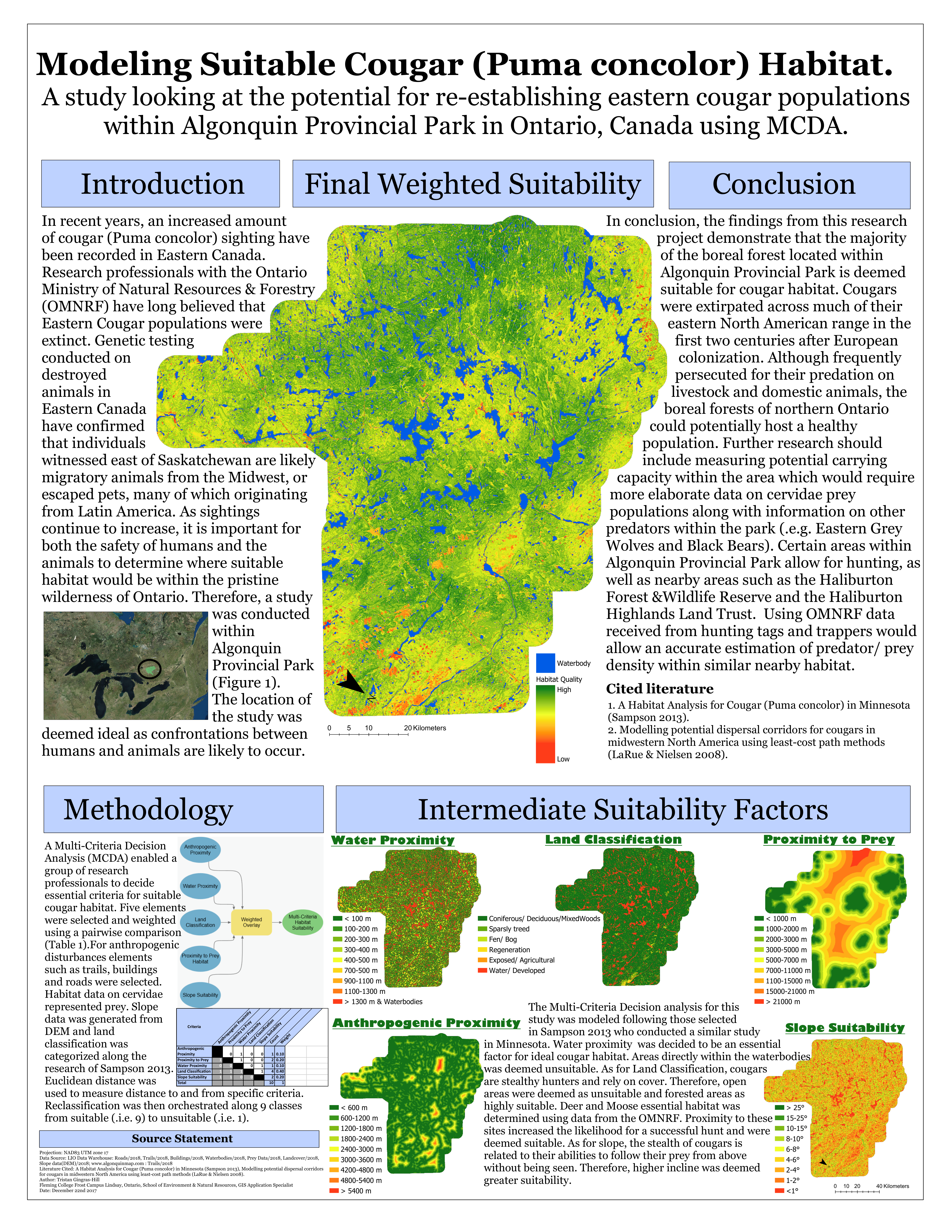
03

Inventory by AI

We are always on the lookout for new technologies
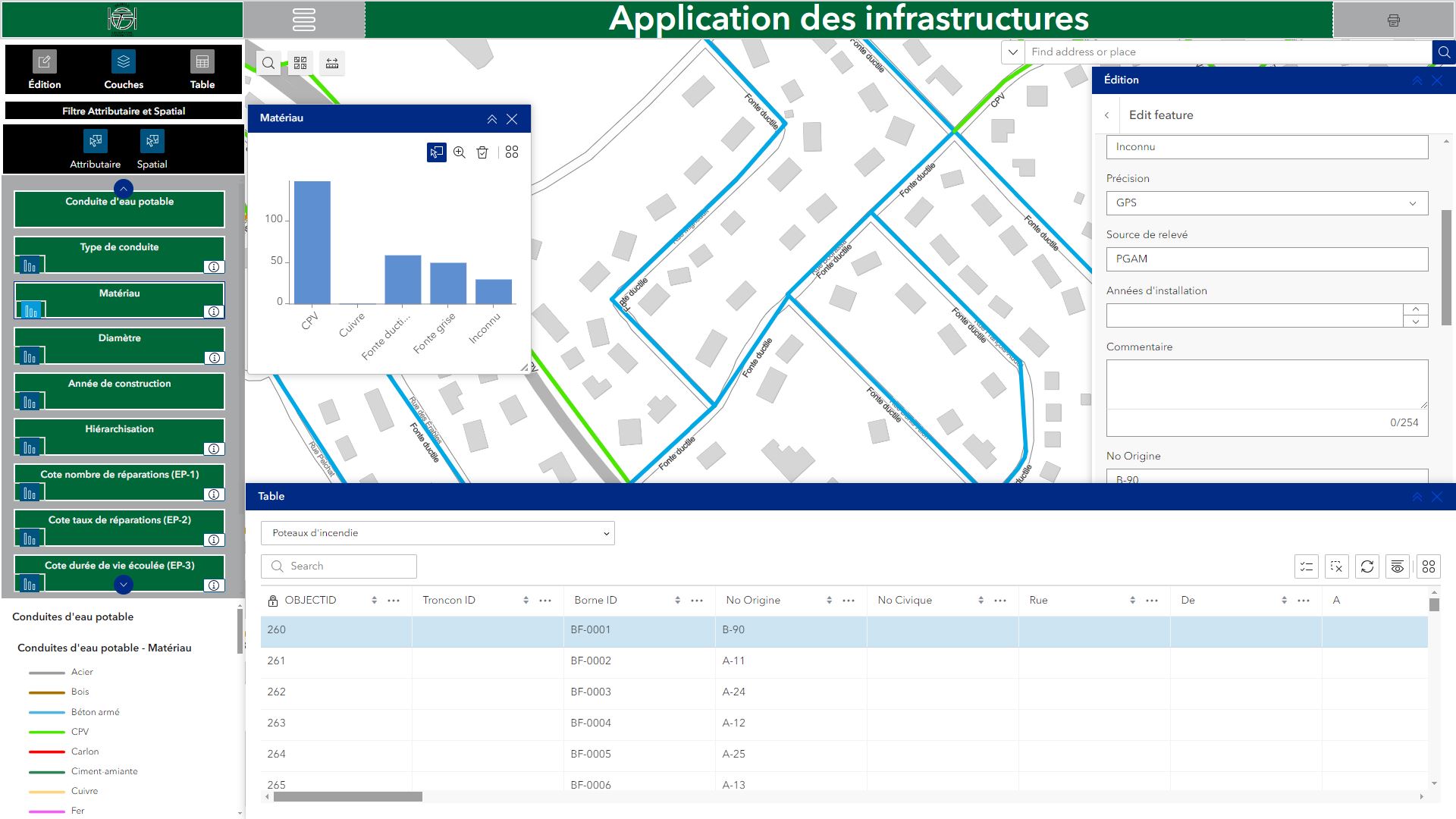
04

Web application

Open-source or proprietary, we are proficient in multiple platforms
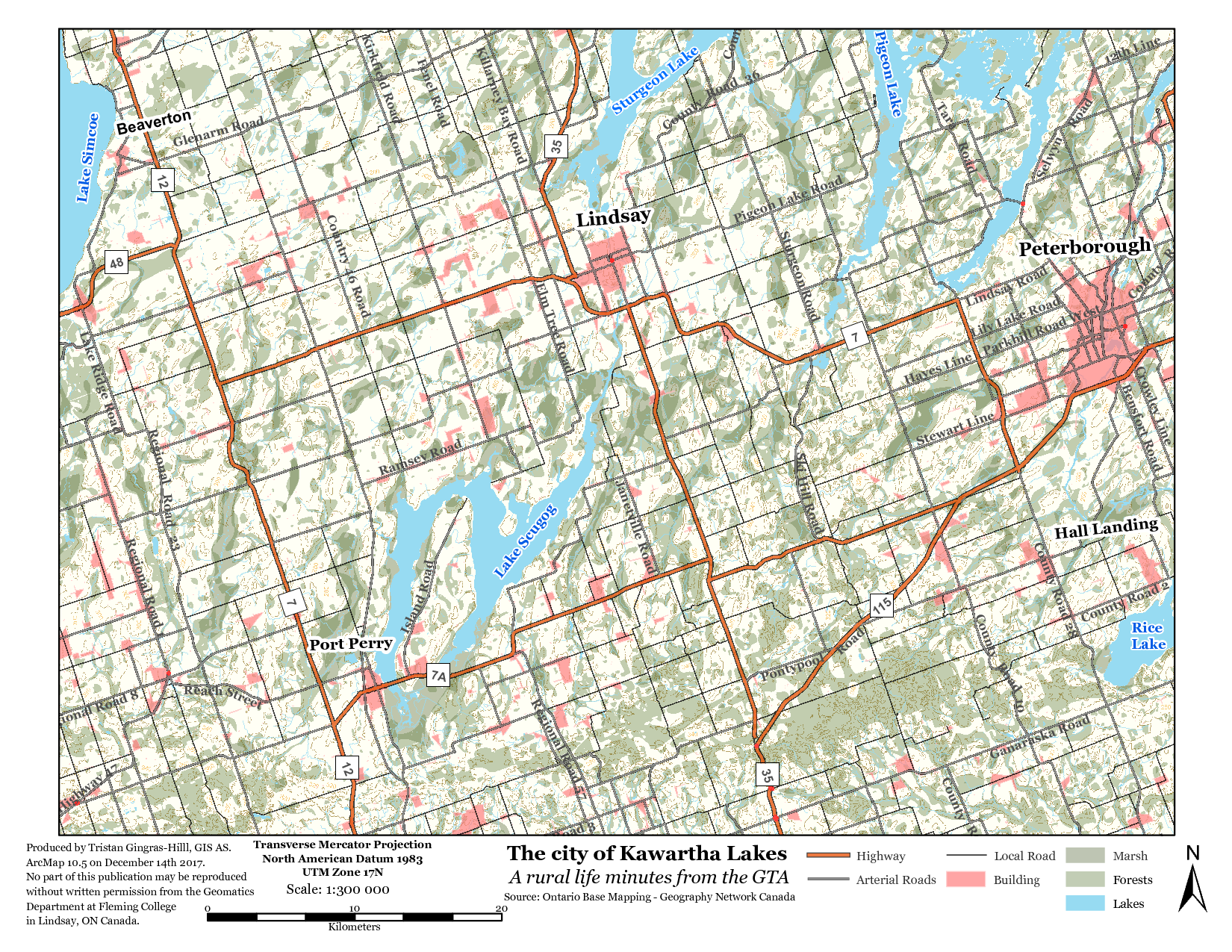
05

Digital mapping

Custom and scale-specific maps tailored to your themes
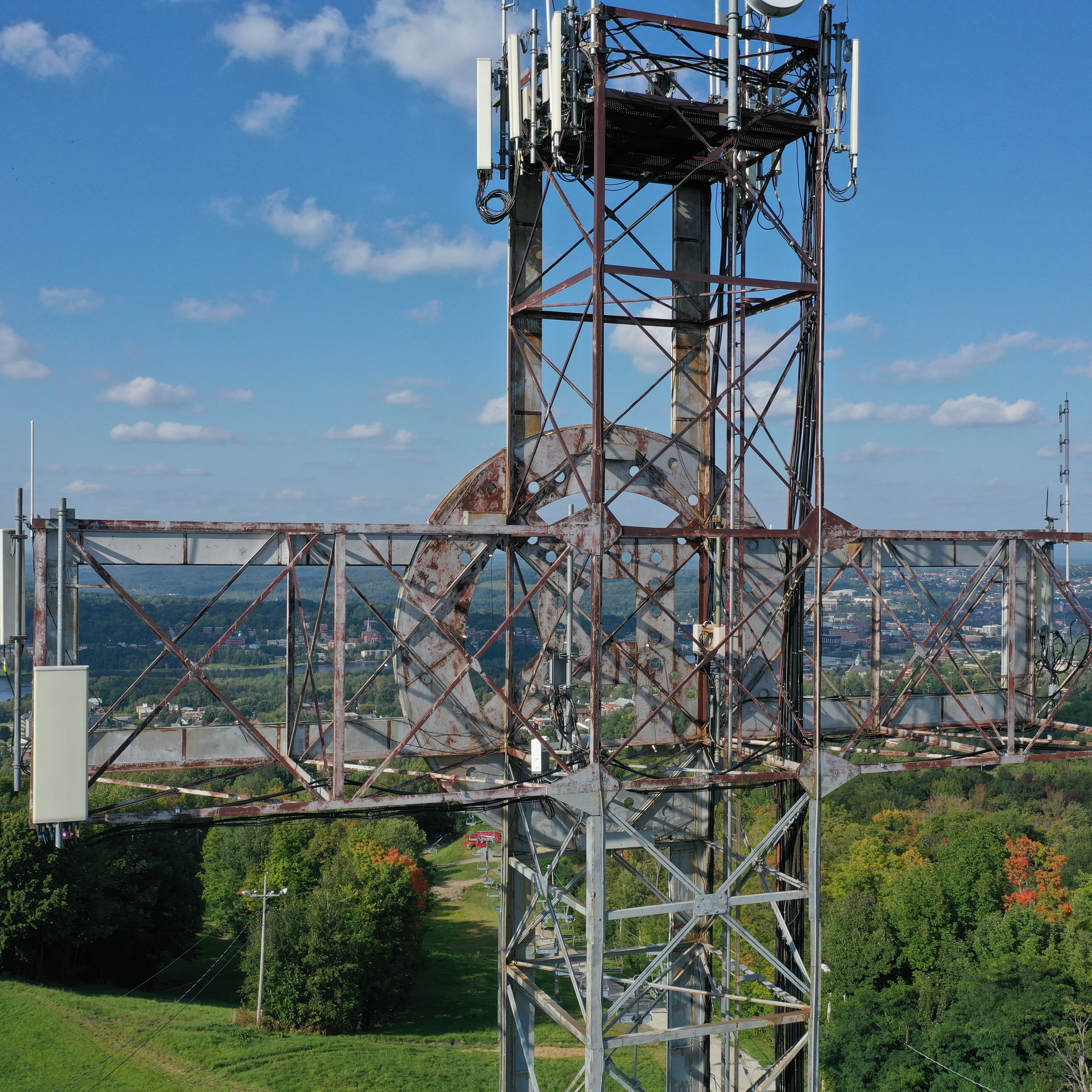
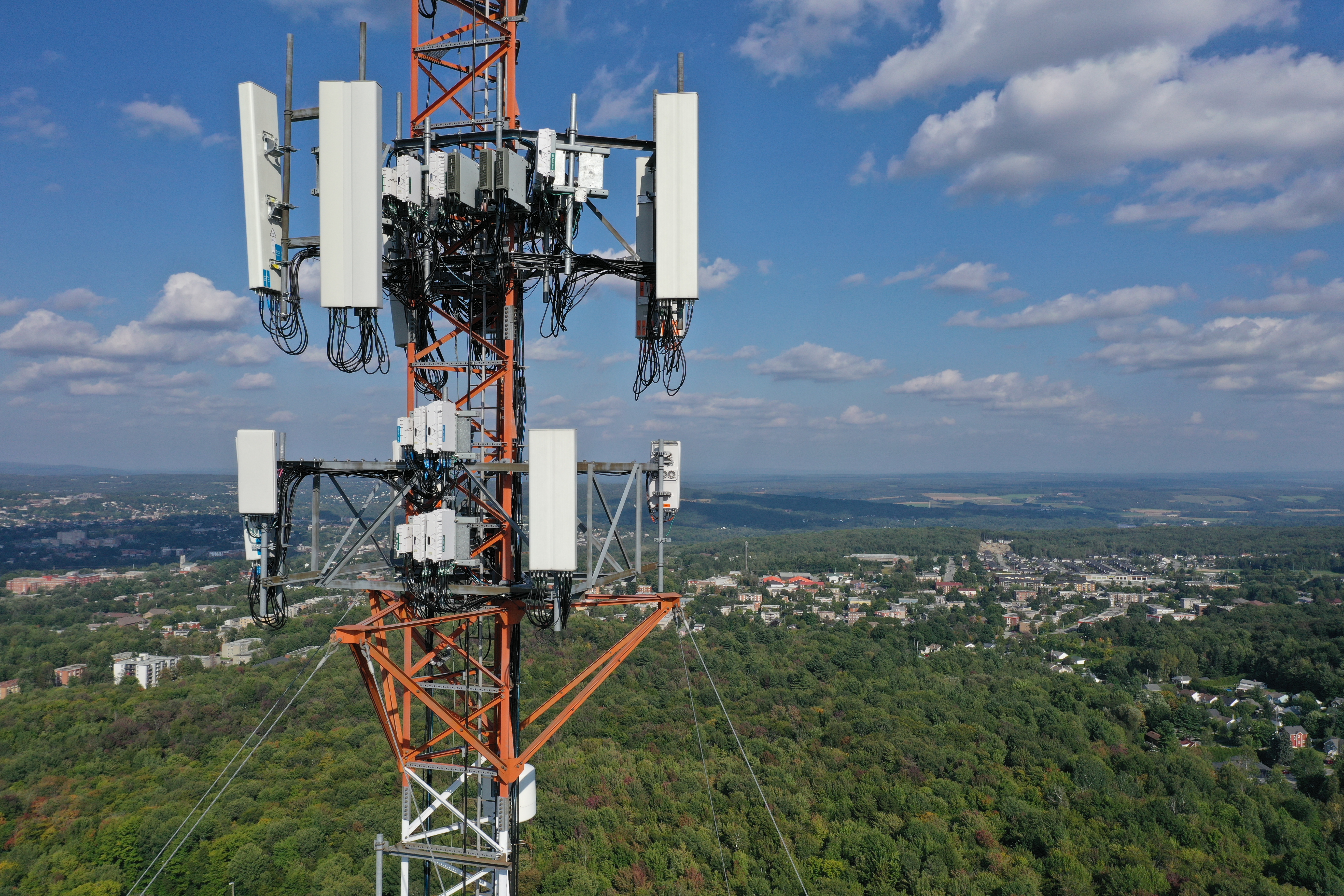
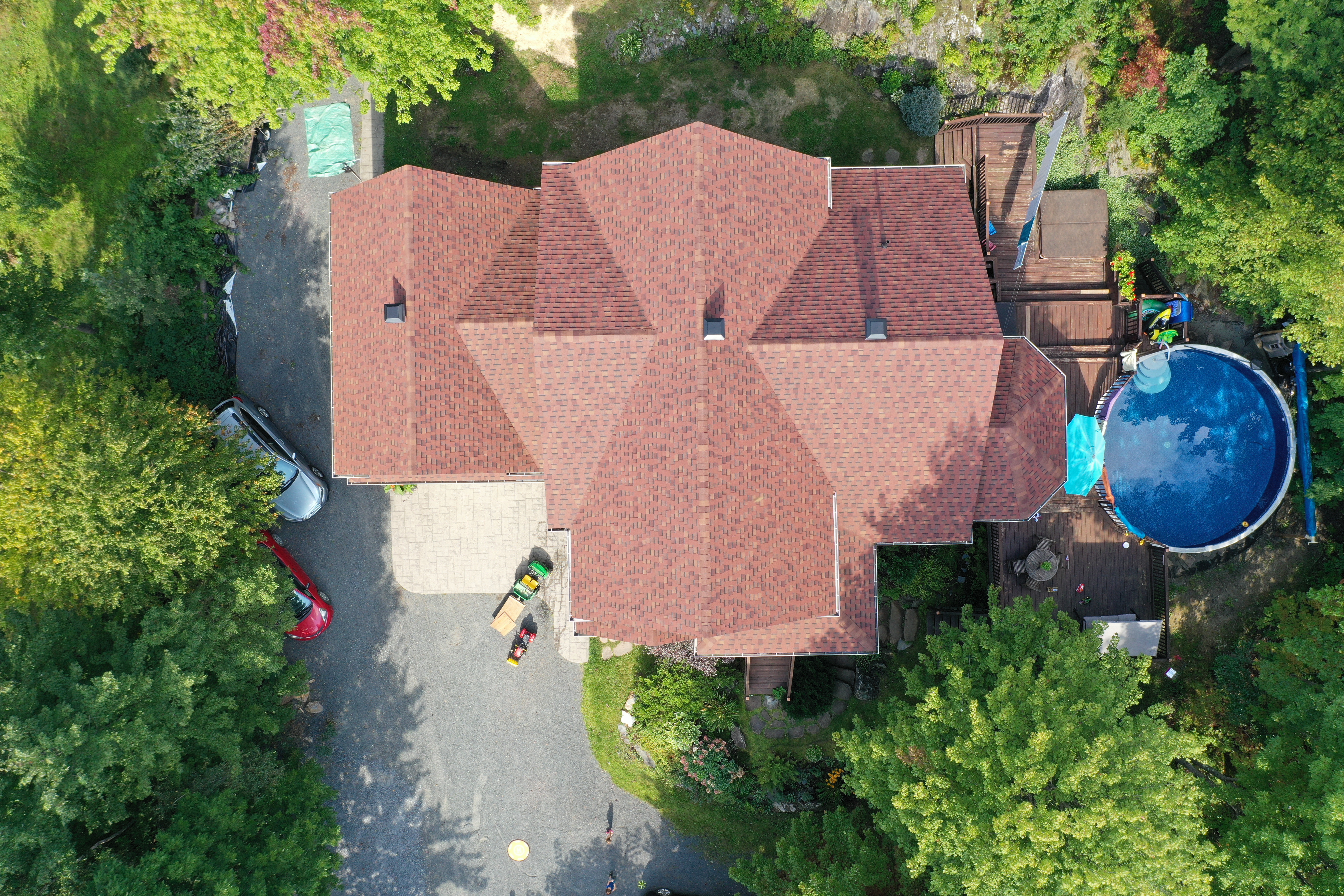
06

Aerial inspection

Avoid dangerous operations with drone inspections

07

Data analysis

Expertise in database management and statistical analysis

08
Svg Vector Icons : http://www.onlinewebfonts.com/icon Svg Vector Icons : http://www.onlinewebfonts.com/icon

Report writing

Writing to support your regulatory projects

Image

Why choose our services?

Over 10 years of experience in the geomatics industry and aerial imagery acquisition

Our drone pilots are certified by Transport Canada to conduct advanced operations missions and have several years of experience in processing photogrammetric products.

Business Analyst, CBAP (Certified Business Analysis Professional)

A business analyst is crucial for geomatics projects because they translate stakeholder needs into clear technical requirements. By understanding the project’s objectives and specific challenges, the analyst identifies the most suitable solutions, ensures process efficiency, and optimizes resources.

Pilot certificate – advanced operations

Our expert pilots in RPAS (Remotely Piloted Aircraft Systems) are ready to take on the challenge. With many years of experience and cutting-edge equipment, we ensure the success of your missions. Our site assessments and flight planning are thorough, including weather checks, necessary permissions, and the implementation of an appropriate emergency plan.

Geospatial industry

Our team of Geographic Information Systems (GIS) experts is proficient in both open-source solutions (QGIS) and proprietary ones (ESRI). With extensive experience across various sectors—including municipal, provincial, federal, private, mining, academic, and technological—we tailor our services to meet your specific needs.

Team

Aerial precision, geospatial analysis

Testimonial author

Tristan Gingras-Hill

I have worked in various sectors, ranging from the forestry industry in the Lac-Saint-Jean region to oil mining in Alberta, and even with the government of the Northwest Territories. I've truly had the opportunity to see a lot and face significant challenges! My passion for technology and Geographic Information Systems led me to extensive experience with Esri Canada. To combine my love for the outdoors and technology, I am certified as an advanced operations drone pilot. Additionally, I hold the CBAP (Certified Business Analysis Professional) certification, which allows me to understand my clients' needs well and provide tailored solutions.

When I’m not in front of my computer, you can find me with my guitar and my dog, doing carpentry, or exploring the beauty of the Eastern Townships.

Testimonial author

Adam Green

I started my career in remote sensing in Western Canada, where I gained expertise in installing and managing weather stations to model habitat restoration disrupted by the oil industry. Over the course of my career, I specialized in project and database management and developed web applications to remotely monitor these stations. My experience with a firm specializing in meteorological equipment allowed me to ensure the success of my clients' projects.

Outside of work, you can find me at my cottage or on the lakes of Ontario with my german sherpard."

Portfolio

See the types of projects we can undertake

Would you like to contact us to discuss your projects?

Contact us if you'd like to discuss your project; we’d be happy to help. Even if we don’t have the exact skills you’re looking for, we’ll assist you in finding the right resource through our extensive network of contacts and partners.

  • Drone or satellite imagery
  • Cartographic and analytical rendering
  • Aerial infrastructure inspection

GET IN TOUCH